Aerial real estate photography helps listings sell by showing the full context in a way ground shots can’t—lot lines, access, parking, sun exposure, and nearby surroundings.
Have you ever wondered how difficult it is to sell real estate? Unless you’re a construction manager or a real estate agent, probably not. Buyers will always have plenty of questions for these professionals, and there isn’t always a clear-cut answer. Which side of the building gets the sun? What if it’s on the first floor? What’s nearby? Where can you park?
A few videos or a set of aerial photography for real estate agents can answer all these questions. It covers most issues regarding location, nearby logistics, and the convenience of living or doing business in a specific area. Today, we’ll explore other ways drones can be used in the real estate and housing sectors.
Don’t feel like reading the whole breakdown right now? Here’s a tighter, more practical summary of what actually changed.
Key Takeaways
- Drone photography answers the questions buyers ask first. It shows sun direction, access, parking, what’s nearby, and how the property sits in the neighborhood.
- Aerial coverage clarifies the lot and layout. Boundaries, slopes, terraces, gardens, pools, and recreation zones are easier to understand from above than from interior shots alone.
- Drones reduce “angle tricks.” They show the real horizon, neighboring buildings, density, and tree lines, which helps set accurate expectations.
- One strong aerial hero angle can replace multiple average ground photos and help a listing stand out across feeds and ads.
- A single flight can generate reusable content for Reels, TikTok, Stories, and virtual tours, which improves the value per shoot.
- For gear, small drones can cover most jobs, but higher-end listings benefit from larger sensors and a tele option to keep facades flattering with less wide-angle distortion.
- Business viability depends on ROI and repeatable delivery. Equipment, training, insurance, and time add up quickly, so pricing must reflect real labor and overhead.
- Post-production is the common bottleneck. Consistent skies, clean shadows, and stable color across a full set often decide whether the final listing looks premium.
- Costs go beyond the drone. Batteries, storage, accessories, licensing, and insurance can push the startup budget into the $1,500 to $2,500 range in typical scenarios.
- Legal and privacy rules vary by country and city. A canceled flight still hurts the client relationship, so planning around regulations and risk is part of the product.
5 Benefits of Using Drones in Real Estate Photography

As you might guess, drones serve many purposes. Although they are currently being used for military purposes in the war in Ukraine and the Middle East, in peacetime and in other countries, they are most commonly used by real estate agents. Here are the benefits of drones in real estate:
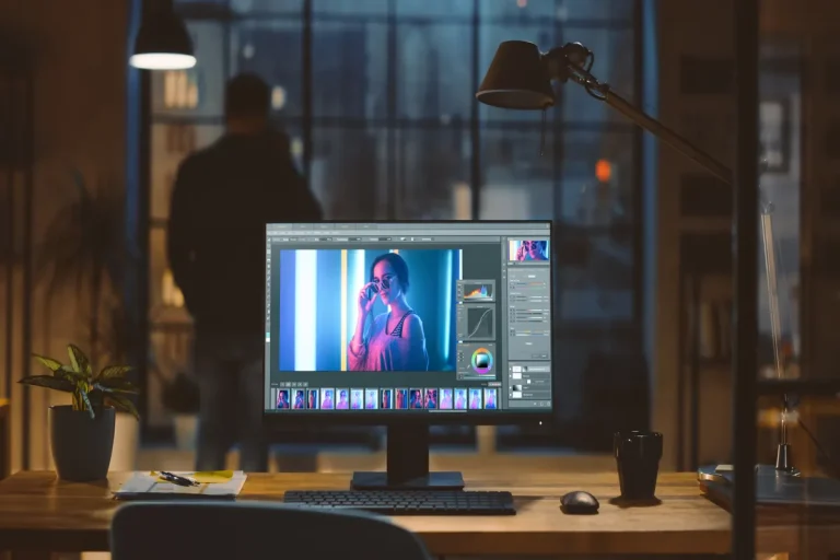
Seamless Sky Replacement with One Click
- A buyer or renter can see the entrance, parking, sun direction, and distance to a road or park in one flight, so the surroundings make sense immediately.
- It shows the property layout clearly—boundaries, terrain, slopes, terraces, gardens, pools, and recreation zones—often more informative than interiors for private homes.
- Instead of flattering ground angles, a drone shows the real horizon, neighboring buildings, density, and tree lines, setting realistic expectations.
- One strong aerial hero angle can replace several average photos, helping a listing stand out in a crowded feed.
- A single flight also produces short clips for Reels, TikTok, Stories, ads, or virtual tours, and the footage can be reused across platforms.
That’s all clear. But what drones should an agency or an individual freelancer specializing in this kind of filming buy?
Popular Drone Models for Real Estate Imaging

How are drones used in real estate? The first thing you need to know is that digital drones are better suited for taking great photos. Analog models produce images that look like they’re coming from an old TV. We compiled a list of models, prices, performance metrics, and main specifications to make the comparison data-driven.
| Model | Approx. Price (USD / EUR) | Camera & Lens (relevant for real estate) | Best for | Pros | Cons |
| DJI Mini 4 Pro | from $759 / from €599 | 1/1.3″ 48MP, 24mm equiv., f/1.7 | Quick listings, smaller homes, social-first content | Compact and easy to travel with. Strong image quality for its size | Less stable in the wind. Smaller sensor than 1-inch options |
| DJI Air 3 | $1,099 / from €879 | Dual 1/1.3″ 48MP cameras: 24mm f/1.7 + 70mm f/2.8 | Versatile real estate shoots needing wide and tighter facade views | 70mm helps keep facades more flattering with less distortion. Flexible framing | Not a 1-inch sensor. Shadows/noise control is weaker than top-tier models |
| DJI Air 3S | $1,099 (base) / $1,399 (Fly More) / ~€1,119 | 1″ 50MP 24mm equiv. + 70mm tele, 4K/60 HDR | Premium listings, dusk/sunset work, HDR-heavy scenes | Cleaner shadows from the 1″ main camera. 70mm adds “premium” framing | Higher cost. The upgrade pays off only if you use the 1″ advantage |
| DJI Mavic 3 Classic | $1,179 (drone only) / $1,279-$1,399 (with controller) | 4/3 CMOS 20MP, 24mm, variable aperture f/2.8-f/11 | Commercial-level exterior work, high-contrast scenes | Large sensor. Variable aperture helps control exposure without heavy ND use | No built-in 70mm option, so tighter facade work may require repositioning |
| DJI Mavic 3 Pro | $2,199 | 4/3 main camera + two tele cameras, ~43 min flight | Agency work, luxury properties, multi-angle coverage | Multiple focal lengths in one flight. Easy to build a full listing story | Expensive. Overkill if you won’t use the tele cameras regularly |
| Autel EVO Lite+ | $1,149 | 1″ 20MP, 29mm equiv., variable aperture f/2.8-f/11 | DJI alternative for exteriors, lots, and wide establishing shots | 1″ sensor and variable aperture. Solid daylight control | Smaller ecosystem than DJI, fewer accessories/tutorials |
| Autel EVO II Pro 6K V3 | $2,099 / ~€1,999 | 1″ sensor, 6K video, ~40 min flight | 6K delivery needs, rugged field workflows | Strong “bundle” approach, 1″ sensor, high-res capture | Larger and pricier than Air/Mini models. 6K isn’t necessary for most listings |
Drones of a small size are typically sufficient for most jobs, whereas higher-paying jobs can use a larger sensor and a telephoto lens to capture a facade without the distortion of a wide-angle lens. Look at wind steadiness and clean evening shadows, and preserve fine features in sunny skies and dark roofs. If the sky looks flat or overexposed, Luminar Neo can help. You can adjust the saturation settings or completely replace the sky using the editor’s built-in algorithms
5 Factors to Consider Before Starting a Drone Photography Business

A big question is whether this venture will pay off. And, of course, using drones for real estate involves equipment, training, insurance, and time spent organizing shoots and ensuring a stable post-production pipeline through which materials can be deployed quickly and consistently. How many factors are to be considered?
- Return on investment in the early years. How much you need to invest in realtor drone photography, how much and how quickly you can expect to earn, and the cost and revenue per shoot. These are the key business metrics that should generally be considered when starting any company.
- Location. It’s hardly worth starting such a business in London, where there are 100-165 rainy days a year. And how many with wind…
- Risk management. This applies to all businesses as well. In short, it involves listing all possible risks and your step-by-step action plan for each. Rest assured, this is inevitable—it’s business.
- Drones will get lost. Just prepare yourself for this possibility and stock up on inexpensive models or set up fast delivery. You might lose contact with them, fly them to the wrong place, lose control, or lose them due to bad weather.
- Legal aspects. In which country will you be operating? What are the laws there? If a bystander is captured on camera, could they sue?
If you approach the issue with a clear strategy, clearly define your target audience, and create a product that addresses people’s needs and challenges, things can work out. But you’ll still have to go through hell to get the business off the ground.
The weakest link is often post-production. A stable sky, clean shadows, consistent color across the series, and quick delivery of materials aren’t “generated” by the drone camera right away. Choose a tool in advance that speeds up the post-production process and helps present the image better to sell the desired product.
Your AI-Powered Photo Editor for MacOS and Windows
Costs and Potential Earnings

How to get into real estate drone photography? The table above lists the cost of some models, but it doesn’t give the complete picture. The set will be the drone, licensing: the DJI Mini 4 Pro at a minimum cost of $759 or the DJI Air 3 at a minimum cost of $1,099, batteries, memory card, and the basic accessories. In the U.S., expect to spend around $175 on the Part 107 exam and insurance, and this can range from a few hundred dollars to well beyond a thousand dollars a year, depending on the insurance limit.
When calculating revenue, it is better to count money per project: the drone charge can be 50-400, with an average of $200. When it requires a 30-45 minute on-site shoot and 45-60 minutes to select and edit a photo, profitability requires a turnaround. Transportation, depreciation, training, and even several additional rounds of revising consume the margin, making the shoot unprofitable shortly.
To break even, establish a basic start-up budget of approximately $1500-2500 for equipment and other expenses, and a net profit per project of $120-180 after time and direct costs. Then the break-even point is approximately 10-20 shoots, and with 2-3 properties per week, this can take several months. Revenue is heavily influenced by the drone photo editor, because in real estate, the picture makes the first impression. Use Luminar Neo, a photo editor offering professional editing tools designed specifically for aerial photography.
Elevate Your Photography with Our Advanced Software
Legal and Ethical Guidelines for Drone Use
Rules vary by country and even by city, and the client seldom learns how a shoot was cancelled; they just know it was cancelled. Pre-flight inspection tips, ways to prevent privacy issues, and ways to establish an effective repeatable process that will keep you, as the homeowner, and the listing safe.
How to Choose the Right Drone for Your Real Estate Needs

Start by analyzing which shots best showcase your properties. For private homes, two types of angles are often needed: a wide-angle shot to show the context and the lot, and a “tight” shot to make the facade look straight without a strong wide-angle effect. Models with a combination of 24mm and 70mm equivalent focal lengths offer flexibility within a single flight.
Next, consider the lighting. When you take a lot of shots at dusk or in cloudy weather, a bigger sensor will give you sharper shadows and better convergence of the sky gradient. A variable aperture is handy when taking listings during the day, as it helps keep exposure stable without continually adjusting the ND filter and prevents loss of sharpness on rooftops and windows. Finally, the best drone for the real estate sector is one that captures facades evenly without degrading the image and does not force you to reshoot due to technical constraints.
Online Communities and Resources for Drone Photographers
To grow faster, keep two types of resources on hand: communities with real-world flight examples and knowledge bases on rules and safety. Common mistakes are best spotted in themed Facebook groups and Discord channels, where people share raw footage, breakdowns of settings, and flight paths. After shooting, it’s helpful to compare post-processing workflows because real estate photo editing software often determines whether a listing looks “more expensive” than competitors.
Tips for Capturing Stunning Aerial Real Estate Photos
Shoot with a series of shots, instead of striving for a single shot: 3-4 heights, 2-3 angles of the facade, and the entrance and courtyard individually. With facades, a longer focal length, where possible, can minimize perspective distortion, and a wide-angle lens can provide context for the neighborhood. Use horizontal shots; do not tilt the shots toward the ground unless necessary, and do not forget to examine the image quality.